Kanpur Metro Phase 2: Corridor 2 Route, Stations & Project
Latest progress and proposed station alignments for Kanpur Metro Phase 2 (Agriculture University to Barra-8) and Naubasta extension.
Direct Answer & Quick Facts
Summary: Kanpur Metro Phase 2 (Corridor 2) connects Agriculture University to Barra-8 across 8.6 km, featuring 8 proposed stations to expand transit across South Kanpur.
Kanpur Metro Phase 2: Corridor 2 Route, Stations & Project Updates
Last Updated: September 2026Get complete details on the construction progress, route alignment, and station details for Kanpur Metro Corridor 2 (Blue Line), connecting north and south Kanpur.
Independent coverage and technical status of Kanpur Metro Phase 2 development, including Blue Line Corridor 2 and Naubasta southern extension.
Corridor 2 Overview (Blue Line)
Route: CSA (Chandra Shekhar Azad) Agriculture University to Barra-8.
Total Length: 8.6 km (approx 4.19 km underground and 4.41 km elevated).
Proposed Stations: Agriculture University, Rawatpur (Key Interchange with Orange Line), Kakadeo, Double Phatak, Vijay Nagar Chauraha, Shastri Chowk, Barra-7, and Barra-8.
Status: Tunnelling and civil viaduct construction actively progressing under UPMRC oversight.
Corridor 2 Fast Facts & Engineering Snapshot
Track the core engineering facts and technical setup behind the Agriculture University to Barra 8 metro corridor.
| Parameter | Corridor 2 / Blue Line Specification | Operational Significance |
|---|---|---|
| Route Alignment | Chandra Shekhar Azad Agriculture University to Barra-8 | Connects northern universities directly to southern residential hubs |
| Total Length | 8.60 km (4.19 km Underground, 4.41 km Elevated) | Splits underground in central areas and elevated across highway roads |
| Funding Agency | European Investment Bank (EIB) & Government Equity | Bilateral loan agreement backing major tunneling and rolling stock costs |
| Rolling Stock | Alstom Movia 3-coach trainsets | Lightweight, regenerative braking trains matching Orange Line units |
| Depot Location | Agriculture University Depot | Dedicated operations, maintenance, and train wash lines |
| Track Gauge | Standard Gauge (1435 mm) | Allows tight curves through congested inner-city segments |
| Traction Power | 750V DC Third Rail | Clean viaduct look without overhead cables |
Kanpur Metro Corridor 2 Stations List
Follow the entire Kanpur metro blue line route map sequence from north to south:
| # | Station Name | Structure | Platform Layout | Civil Construction Status | Area Served |
|---|---|---|---|---|---|
| 1 | Agriculture University (CSAU) | Underground | Island Platform | Terminal Hub | CSAU Campus, Nawabganj, Allen Forest Zoo |
| 2 | Rawatpur | Underground | Island Platform | Major Interchange | Connects with Line 1 (Orange Line) & Rawatpur Rail Station |
| 3 | Kakadeo | Underground | Island Platform | Active Civil Works | Major student coaching hub, central marketplaces |
| 4 | Double Phatak | Underground | Island Platform | Under Construction | Shastri Nagar crossing, congested railway gate area |
| 5 | Vijay Nagar Chauraha | Elevated | Side Platforms | Pier Work | Bypass junction, Dada Nagar Industrial Area |
| 6 | Shastri Chowk | Elevated | Side Platforms | Pier Work | Govind Nagar residential pockets, local markets |
| 7 | Barra-7 | Elevated | Side Platforms | Piling Work | Barra residential neighborhoods, local clinics |
| 8 | Barra-8 | Elevated | Side Platforms | Terminal Station | Southern city terminal, Highway feeder connections |
Alignment Breakdown: Underground Tunnel vs. Elevated Viaduct
The 8.6 km Blue Line contains two clear sections:
Kanpur Metro Underground Tunnel Corridor 2
The 4.19 km subterranean tunnel stretches from Agriculture University through Rawatpur and Kakadeo to Double Phatak. Multiple Tunnel Boring Machines (TBMs) are deployed by civil teams to carve twin tunnels 15 to 18 meters beneath heavily populated roads. This underground method protects older buildings above while digging out station boxes in tight spaces.
Transition Ramp & Elevated Viaduct
The line climbs through an open cut-and-cover ramp past Double Phatak and rises on pillars toward Vijay Nagar Chauraha. From there, a 4.41 km elevated concrete viaduct follows the central median of the southern ring roads to Barra-8 without stopping city vehicular traffic.
Civil Construction Packages & Contractor Details
Work on the Kanpur metro phase 2 tender package segments is divided among major infrastructure builders:
| Package Code | Scope of Civil Work | Contractor / Consortium | Status |
|---|---|---|---|
| KNPCC-11 | Design and building of twin tunnels and 4 underground stations (CSAU to Double Phatak) | KPIL – Gulermak JV | Active Tunneling (TBM) |
| KNPCC-12 | Construction of viaduct and 4 elevated stations (Vijay Nagar Chauraha to Barra-8) | Ceigall India Ltd. | Under-Construction Viaducts |
| KNP-TR-02 | Supply and installation of ballastless track tracks | Larsen & Toubro (L&T) | Approved Package |
| KNP-ELEC-02 | Power supply, 750V DC third rail, and SCADA system | Siemens / Alstom Consortium | Approved Package |
The Rawatpur Metro Interchange Blue Line: Walkthrough
Rawatpur is set to become the busiest junction on the entire metro network:
- Integrated Concourse: You will find the elevated Line 1 platforms sitting above ground level along GT Road. Below, the new Line 2 platforms run underground.
- Direct Transfer Gates: Moving from the Orange Line to the Blue Line happens inside the fare paid zone. Passengers take escalators or lifts between levels without passing through new ticket barriers.
- Rail Connectivity: The station entrance connects right to Rawatpur Railway Station (NER), letting regional train commuters walk straight into the metro.
Neighborhood Impact & Daily Commuter Benefits
How the upcoming line helps cut daily travel time:
| Locality | Traffic Bottleneck Bypassed | Direct Station | Key Beneficiaries |
|---|---|---|---|
| Kakadeo | Coaching center traffic, auto jams | Kakadeo | Students, professors, shop workers |
| Double Phatak | Railway crossing closures and delays | Double Phatak | Daily office commuters, delivery vans |
| Govind Nagar | Market blockades and dense junctions | Shastri Chowk | Local business owners, market shoppers |
| Barra Sectors | Bypass highway intersection choke points | Barra-7 & Barra-8 | South Kanpur suburban residents |
Projected Travel Times & Fare Matrix
Check the expected travel times using the Kanpur metro travel time route planner data:
| Origin Station | Destination Station | Road Time | Metro Time | Standard Fare | GoSmart Card Fare (10% Off) |
|---|---|---|---|---|---|
| Agriculture University | Rawatpur | 15 mins | 4 mins | ₹10 | ₹9 |
| Kakadeo | Kanpur Central (via Rawatpur) | 45 mins | 14 mins | ₹30 | ₹27 |
| Barra-8 | Rawatpur | 35 mins | 11 mins | ₹20 | ₹18 |
| Barra-8 | IIT Kanpur (via Rawatpur) | 65 mins | 25 mins | ₹40 | ₹36 |
| Govind Nagar / Shastri Chowk | Motijheel | 30 mins | 12 mins | ₹20 | ₹18 |
Interactive Project Tracker & Media Elements
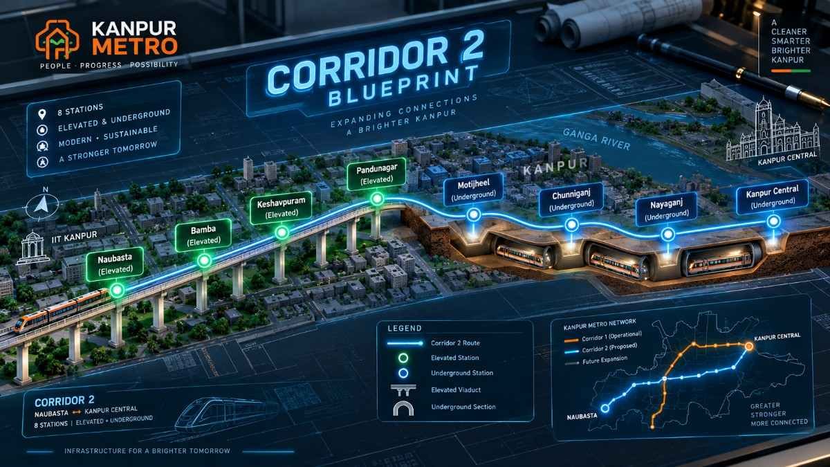
Track tunnel boring status, pillar casting, and station foundation milestones directly:
Get real-time service notifications and construction status:
Check Daily Transit & City UpdatesWhy We Built This Corridor 2 Project Guide
Students heading to coaching classes in Kakadeo, patients traveling to hospitals, and daily commuters fighting bottlenecks around Double Phatak need clear, honest information. We built this tracking portal to give you real status reports on lines, stations, and openings. Knowing the plan lets you plan your daily schedule and escape road congestion.
Challenges & Engineering Hurdles on Corridor 2
Building the Blue Line requires overcoming major civil engineering challenges across dense urban zones:
- Kakadeo Underground Spaces: Tunneling under packed residential and educational blocks calls for careful soil monitoring to avoid foundation settlement.
- Double Phatak Railway Crossing: Crossing active Indian Railways tracks demands complex engineering to prevent railway traffic disruptions.
- Utility Congestion: Relocating dense water lines, sewer lines, and underground electric feeds along older streets.
- Busy Road Intersections: Erecting piers at Vijay Nagar Chauraha requires careful lane management to avoid blocking arterial traffic.
Project Timeline, Milestones & Deadlines
Follow critical dates and progress stages toward the Kanpur metro phase 2 completion date.
| Milestone / Event | Target Date | Status / Progress Note | Phase Badge |
|---|---|---|---|
| DPR and Cabinet Clearance | 2019 | Approved by Union Government | Completed |
| EIB Financial Approval | 2020 | Funding loan cleared | Completed |
| Awarding of KNPCC-11 & KNPCC-12 Tenders | 2022 / 2023 | Construction contractors finalized | Completed |
| TBM Tunneling Operations (Underground Section) | 2024 - 2025 | Twin tunneling between CSAU and Double Phatak | Active Works |
| Viaduct Pier Work & Girder Erection | 2024 - 2025 | Elevated column construction ongoing in South Kanpur | Active Works |
| Trial Runs & Track Electrification | Mid 2026 | Integrated system trials | Upcoming |
| Commercial Passenger Launch | Late 2026 | Target full opening for public travel | Target Deadline |
1. What is the total length of the route in Kanpur Metro Phase 2: Corridor 2 Route, Stations & Project Updates?
The total route length under Kanpur Metro Phase 2: Corridor 2 Route, Stations & Project Updates is 8.60 km, extending from CSA Agriculture University to Barra-8.
2. What is the latest progress on Kanpur Metro Phase 2: Corridor 2 Route, Stations & Project Updates?
Current reports on Kanpur Metro Phase 2: Corridor 2 Route, Stations & Project Updates show ongoing underground tunneling with TBMs and pillar construction along the elevated stretch.
3. Which stops are included in the Kanpur Metro Phase 2: Corridor 2 Route, Stations & Project Updates?
The 8 stations listed in Kanpur Metro Phase 2: Corridor 2 Route, Stations & Project Updates are Agriculture University, Rawatpur, Kakadeo, Double Phatak, Vijay Nagar Chauraha, Shastri Chowk, Barra-7, and Barra-8.
4. Where can I find the alignment map for Kanpur Metro Phase 2: Corridor 2 Route, Stations & Project Updates?
You can check the official alignment map for Kanpur Metro Phase 2: Corridor 2 Route, Stations & Project Updates on our portal or on the official UPMRC website.
5. What areas are linked by Kanpur Metro Phase 2: Corridor 2 Route, Stations & Project Updates?
Kanpur Metro Phase 2: Corridor 2 Route, Stations & Project Updates connects the northern institutional belt at Agriculture University to the southern residential neighborhoods of Barra-8.
6. How does the Rawatpur junction work in Kanpur Metro Phase 2: Corridor 2 Route, Stations & Project Updates?
As detailed in Kanpur Metro Phase 2: Corridor 2 Route, Stations & Project Updates, Rawatpur serves as an interchange allowing direct transfers between the elevated Orange Line and underground Blue Line.
7. What is the target completion date in Kanpur Metro Phase 2: Corridor 2 Route, Stations & Project Updates?
According to the project schedule in Kanpur Metro Phase 2: Corridor 2 Route, Stations & Project Updates, the targeted commercial launch is set for late 2026.
8. What is the current status of Kakadeo station in Kanpur Metro Phase 2: Corridor 2 Route, Stations & Project Updates?
The Kakadeo station under Kanpur Metro Phase 2: Corridor 2 Route, Stations & Project Updates is an underground stop where diaphragm wall work and excavation are actively progressing.
9. How long is the underground tunnel in Kanpur Metro Phase 2: Corridor 2 Route, Stations & Project Updates?
The underground tunnel section in Kanpur Metro Phase 2: Corridor 2 Route, Stations & Project Updates measures 4.19 km from Agriculture University to Double Phatak.
10. Who was awarded the underground package in Kanpur Metro Phase 2: Corridor 2 Route, Stations & Project Updates?
Contract package KNPCC-11 in Kanpur Metro Phase 2: Corridor 2 Route, Stations & Project Updates was awarded to the KPIL-Gulermak Joint Venture.
11. Where do I get official news on Kanpur Metro Phase 2: Corridor 2 Route, Stations & Project Updates?
Official alerts and releases regarding Kanpur Metro Phase 2: Corridor 2 Route, Stations & Project Updates are published by UPMRC and mirrored on our transit portal.
12. How many underground stations are built in Kanpur Metro Phase 2: Corridor 2 Route, Stations & Project Updates?
There are 4 underground stations in Kanpur Metro Phase 2: Corridor 2 Route, Stations & Project Updates: Agriculture University, Rawatpur, Kakadeo, and Double Phatak.
13. How many elevated stations are planned in Kanpur Metro Phase 2: Corridor 2 Route, Stations & Project Updates?
There are 4 elevated stations in Kanpur Metro Phase 2: Corridor 2 Route, Stations & Project Updates: Vijay Nagar Chauraha, Shastri Chowk, Barra-7, and Barra-8.
14. Where is the train depot placed in Kanpur Metro Phase 2: Corridor 2 Route, Stations & Project Updates?
The maintenance depot in Kanpur Metro Phase 2: Corridor 2 Route, Stations & Project Updates is located within the grounds of CSA Agriculture University.
15. Which train models are specified in Kanpur Metro Phase 2: Corridor 2 Route, Stations & Project Updates?
Per Kanpur Metro Phase 2: Corridor 2 Route, Stations & Project Updates, trains are 3-coach stainless steel Alstom Movia units equipped with regenerative braking.
16. What traction system is used in Kanpur Metro Phase 2: Corridor 2 Route, Stations & Project Updates?
The line covered by Kanpur Metro Phase 2: Corridor 2 Route, Stations & Project Updates uses a 750V DC third-rail electrification system.
17. What track gauge is laid in Kanpur Metro Phase 2: Corridor 2 Route, Stations & Project Updates?
All tracks under Kanpur Metro Phase 2: Corridor 2 Route, Stations & Project Updates are built using the international standard gauge of 1435 mm.
18. What is the travel time between Agriculture University and Rawatpur in Kanpur Metro Phase 2: Corridor 2 Route, Stations & Project Updates?
Under Kanpur Metro Phase 2: Corridor 2 Route, Stations & Project Updates, the train run time between these two stops is estimated at about 4 minutes.
19. Can I reach Kanpur Central quickly according to Kanpur Metro Phase 2: Corridor 2 Route, Stations & Project Updates?
Yes, commuters can travel from Kakadeo to Kanpur Central in roughly 14 minutes by switching lines at Rawatpur under Kanpur Metro Phase 2: Corridor 2 Route, Stations & Project Updates.
20. Will GoSmart cards work on the route in Kanpur Metro Phase 2: Corridor 2 Route, Stations & Project Updates?
Yes, GoSmart cards work on all turnstiles across both lines featured in Kanpur Metro Phase 2: Corridor 2 Route, Stations & Project Updates.
21. Is there a fare discount available in Kanpur Metro Phase 2: Corridor 2 Route, Stations & Project Updates?
Passengers using GoSmart smart cards receive an automatic 10% discount on all fares under Kanpur Metro Phase 2: Corridor 2 Route, Stations & Project Updates.
22. Where is the transition ramp built in Kanpur Metro Phase 2: Corridor 2 Route, Stations & Project Updates?
The ramp bringing tracks from underground to elevated level sits past Double Phatak before Vijay Nagar in Kanpur Metro Phase 2: Corridor 2 Route, Stations & Project Updates.
23. Who is constructing the elevated viaduct in Kanpur Metro Phase 2: Corridor 2 Route, Stations & Project Updates?
Package KNPCC-12 of Kanpur Metro Phase 2: Corridor 2 Route, Stations & Project Updates is being constructed by Ceigall India Ltd.
24. How does the route connect to Indian Railways in Kanpur Metro Phase 2: Corridor 2 Route, Stations & Project Updates?
Under Kanpur Metro Phase 2: Corridor 2 Route, Stations & Project Updates, passengers get direct access to Rawatpur Railway Station (NER) and quick transfer to Kanpur Central.
25. What is the base fare for a short trip in Kanpur Metro Phase 2: Corridor 2 Route, Stations & Project Updates?
Single-journey travel starts at ₹10 for the first zone under Kanpur Metro Phase 2: Corridor 2 Route, Stations & Project Updates.
26. How deep will the underground stations be in Kanpur Metro Phase 2: Corridor 2 Route, Stations & Project Updates?
Station boxes in Kanpur Metro Phase 2: Corridor 2 Route, Stations & Project Updates are built between 15 and 18 meters below road level.
27. Are platform screen doors included in Kanpur Metro Phase 2: Corridor 2 Route, Stations & Project Updates?
All underground stations in Kanpur Metro Phase 2: Corridor 2 Route, Stations & Project Updates will feature platform screen doors for enhanced commuter safety.
28. Which major highway connects to the terminal in Kanpur Metro Phase 2: Corridor 2 Route, Stations & Project Updates?
The southern terminal at Barra-8 connects directly with the NH-19 corridor under Kanpur Metro Phase 2: Corridor 2 Route, Stations & Project Updates.
29. What is the passenger capacity per train in Kanpur Metro Phase 2: Corridor 2 Route, Stations & Project Updates?
Each 3-coach train featured in Kanpur Metro Phase 2: Corridor 2 Route, Stations & Project Updates is designed to accommodate approximately 970 passengers.
30. Can mobile app QR tickets be used in Kanpur Metro Phase 2: Corridor 2 Route, Stations & Project Updates?
Yes, mobile QR tickets generated on the official UPMRC app will scan at all turnstiles in Kanpur Metro Phase 2: Corridor 2 Route, Stations & Project Updates.
Was this Kanpur Metro transit guide helpful?
Help us improve Kanpur transit intelligence for 1.5M+ daily commuters.